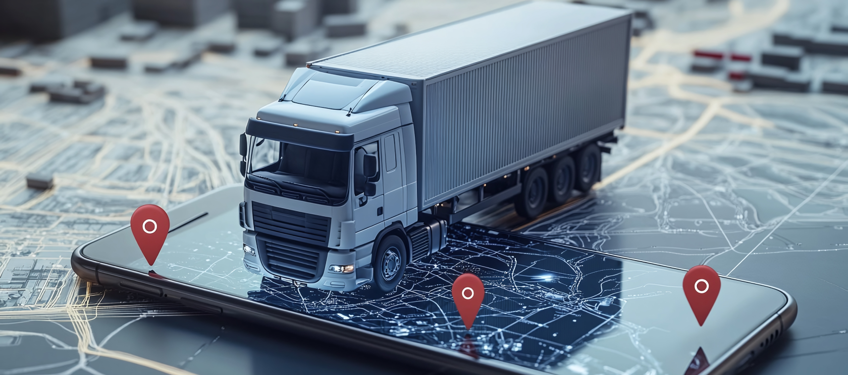
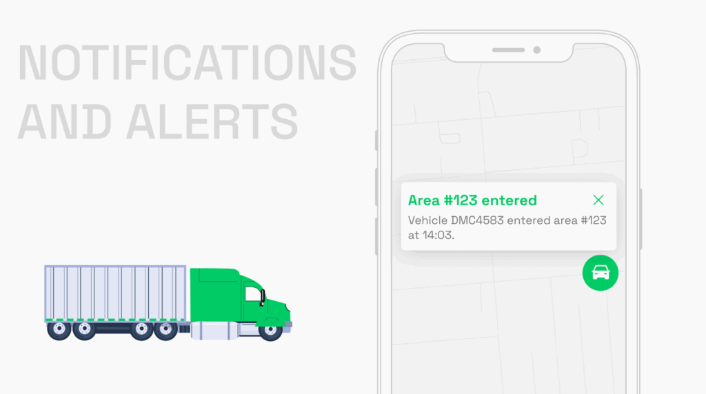
What exactly is geofencing in logistics? Geofencing allows companies to create virtual boundaries, or “fences,” around specific locations. This technology uses GPS, RFID, or Wi-Fi to define these boundaries and enables businesses to receive real-time alerts when assets or vehicles enter or exit designated areas.
When your trucks roll in or out, things happen automatically – like sending a notification, updating inventory, or unlocking a gate. if you’re in the logistics game and not using geofencing yet, you’re seriously missing out.
Over the past 8 years, our team has perfected their craft by creating custom logistics apps tailored to the unique needs of logistics companies. In this article, we want to explore all the ins and outs of implementing geofencing in logistics operations and building custom apps to integrate geofencing features.
And if you’re thinking about building a custom app for your company (or adding new features), we would be happy to answer all your questions, tailor geofencing solutions to your specific needs, or just give honest advice. You can always connect with us via info@volpis.com
What is geofencing & how does it work in logistics
Geofencing in logistics is like putting up invisible walls around a spot using GPS, RFID technology, Wi-Fi, or cellular data.
When an object, such as a vehicle or mobile device, crosses these virtual perimeters, the system triggers pre-defined actions, like sending notifications, updating records, or initiating automated workflows.
It’s perfect for tracking vehicles in real time, ensuring they stay on route, and streamlining deliveries. For example, when a truck arrives at a customer’s location, the system automatically alerts them. This boosts operational efficiency and keeps everyone informed without any extra effort.
Top practical uses of geofencing in logistics (2026)
Geofencing technology can do a ton in the logistics industry, making everything run smoother, safer, and easier to track in real time. Check out some of the top ways geofencing is changing how things get done.
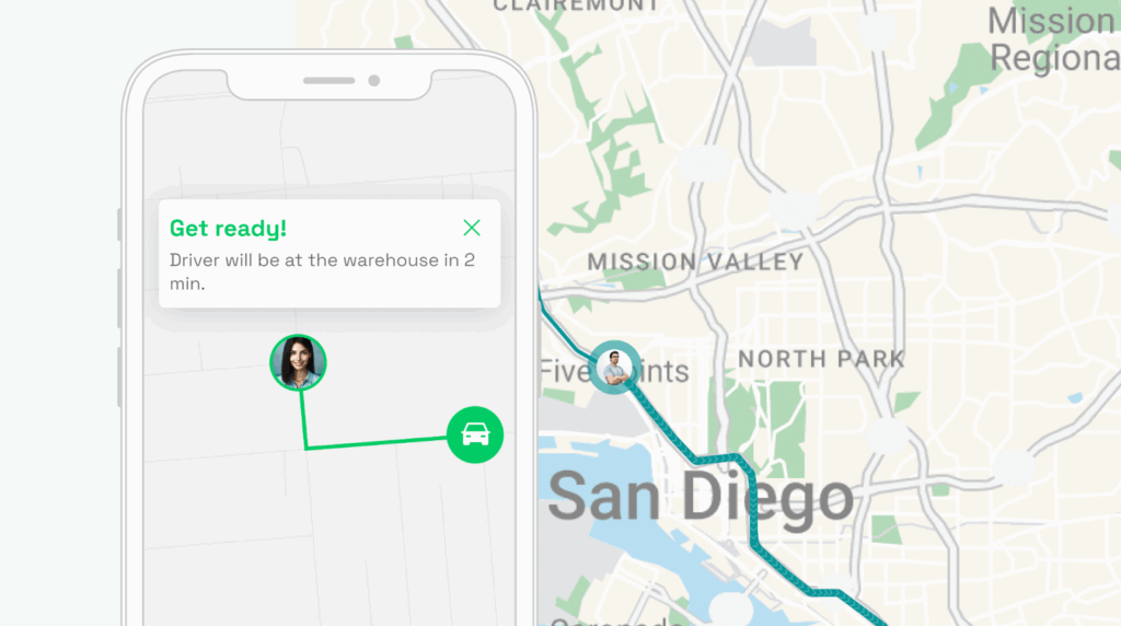
1. Last-mile delivery notifications

One of the most effective applications of geofencing in logistics is during last-mile deliveries. By setting up geofences around customer delivery locations, fleet managers can automate notifications that alert both customers and dispatchers when a vehicle is approaching its destination. This can help:
- Improve customer experience with your company by providing accurate delivery time estimates.
- Reduce the number of missed deliveries by ensuring customers are notified in advance.
- Enhance transparency with real-time updates on delivery status.
Example: A logistics company delivering packages can trigger automatic SMS or email notifications to customers when a delivery truck is within a set radius of the customer’s address, allowing customers to prepare for the delivery.
2. Improved security
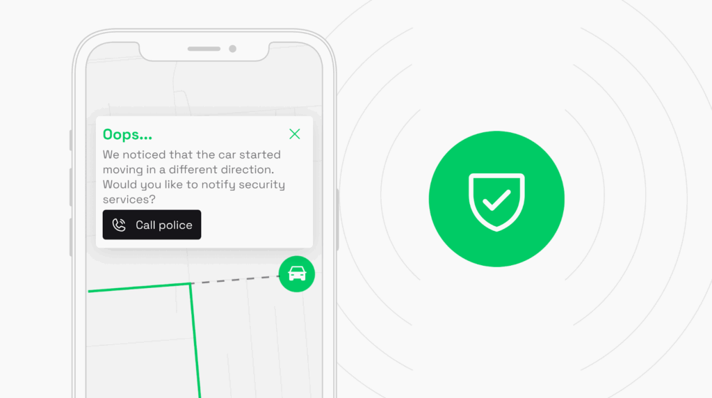
Geofencing can enhance security by creating virtual boundaries around depots, distribution centers, or restricted areas. When vehicles or assets enter or leave these zones, you will be instantly notified, allowing for real-time monitoring of movements. This can help:
- Prevent unauthorized vehicle usage or theft by alerting managers if vehicles exit predefined areas outside of scheduled routes or times.
- Ensure valuable cargo remains within secure zones until the correct time for departure or transfer.
Example: You can set up a geofence around a high-security warehouse. If any vehicle enters or exits the geofence outside of normal operating hours, the system automatically triggers an alert, helping to prevent theft or unauthorized access.
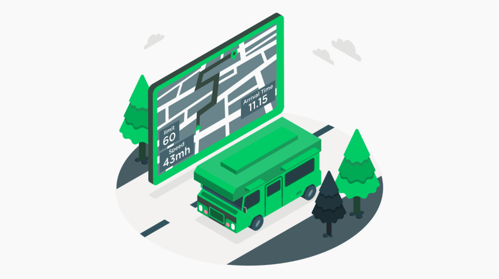
3. Driver behavior monitoring
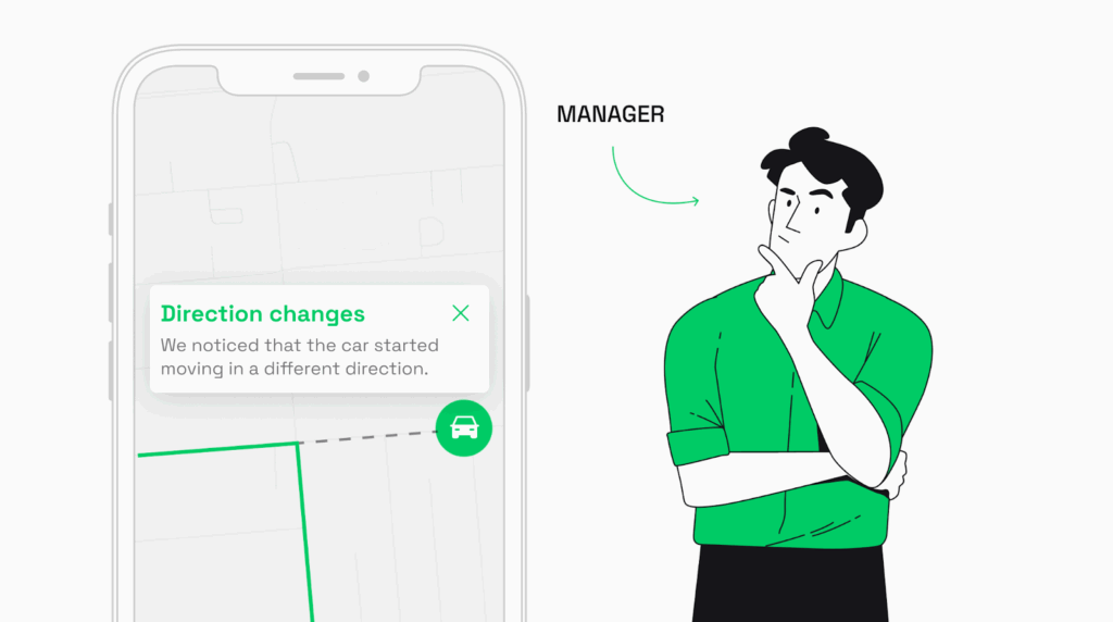
You can use geofencing to monitor and control driver behavior, ensuring drivers stick to planned routes and avoid unauthorized stops or deviations. Geofencing can also be used to detect specific driving behaviors within certain zones, such as speeding or idling.
- Ensures adherence to pre-determined routes and schedules.
- Helps reduce fuel consumption by preventing unnecessary detours.
- Enhances accountability by tracking vehicle movement in real-time.
Example: You might set up geofences along designated routes. If a driver deviates from the route, an alert is triggered, allowing managers to check if the deviation was authorized and take corrective action if needed.
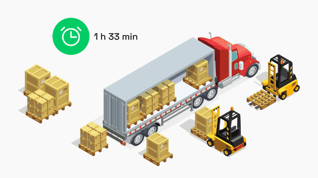
4. Automated yard and warehouse management

Geofencing can automate various processes within logistics hubs like warehouses and distribution centers. When vehicles enter or exit a geofenced area, the system can automatically log their arrival and departure times, eliminating manual entry and improving operational efficiency.
- Improves accuracy in vehicle tracking and reduces administrative workload.
- Enables seamless check-ins and check-outs for trucks, reducing congestion.
- Enhances overall yard management by optimizing dock assignments and vehicle movement.
Example: You can use geofencing to automate check-in procedures at a warehouse. When a delivery truck crosses into the geofenced perimeter of the warehouse, it is automatically logged into the system, and an available dock is assigned without the need for manual input.
5. Ensuring compliance & route monitoring

Geofencing is a powerful tool that can help ensure that drivers comply with restricted zones, environmental regulations, or road restrictions (such as avoiding certain roads or areas with height or weight limits). It allows managers to monitor and enforce compliance with delivery zones and route regulations.
- Ensures vehicles remain within legal or company-defined boundaries.
- Helps avoid fines and penalties for entering restricted or prohibited zones.
- Promotes adherence to environmental regulations by restricting vehicles from entering low-emission zones.
Example: A fleet transporting heavy goods can use geofencing to prevent vehicles from entering areas with weight restrictions or low-emission zones, automatically triggering automated alerts if a driver approaches restricted areas.
6. Optimizing vehicle utilization and routing
Geofencing can provide valuable insights into the movement patterns of vehicles, allowing logistics managers to optimize routes and fleet utilization. By tracking how long vehicles spend in specific geofenced areas (like loading docks or delivery zones), managers can identify inefficiencies and adjust operations accordingly.
- Reduces downtime by optimizing routes and schedules based on real-time location data.
- Improves asset utilization by identifying underperforming or overused vehicles.
- Increases fleet productivity by minimizing unnecessary delays at key checkpoints.
Example: By analyzing how long vehicles spend at a loading dock, a logistics company can adjust staffing levels or operational procedures to reduce wait times and improve throughput.
7. Geofencing for customer-specific zones
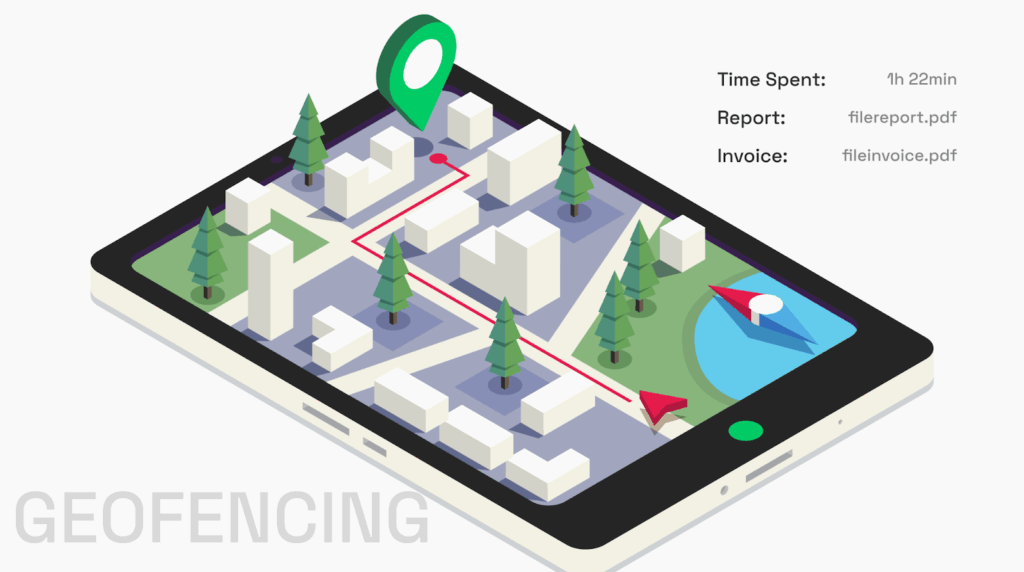
Geofencing can be tailored to meet the needs of specific customers, creating dedicated zones around their locations. This allows for more personalized services, such as priority alerts for high-value customers or automated billing and reporting when vehicles enter or exit a customer’s premises.
- Enables customized service levels for key clients.
- Provides automated billing based on precise time spent in a customer’s location.
- Offers real-time tracking and reporting for customer transparency.
Example: A logistics provider serving multiple customers can create geofences around each customer’s facility. When a vehicle enters a customer’s location, the system logs the time spent and automatically generates a report or invoice for that specific job.
8. Cold chain logistics monitoring

For industries that require temperature-controlled shipments, such as pharmaceuticals or food, geofencing can be used to monitor critical conditions like temperature or humidity when vehicles enter specific zones. Alerts can be triggered if environmental conditions fall outside acceptable ranges.
- Ensures compliance with regulatory standards for temperature-sensitive goods.
- Protects product integrity by monitoring conditions in real time.
- Automates the reporting of environmental data for audits and compliance.
Example: A cold chain logistics company transporting perishable goods can set up geofences around temperature-controlled storage facilities. If the vehicle’s temperature deviates from the required range within these zones, the system sends an alert to the manager, enabling quick corrective action.
9. Simplify time and payroll management
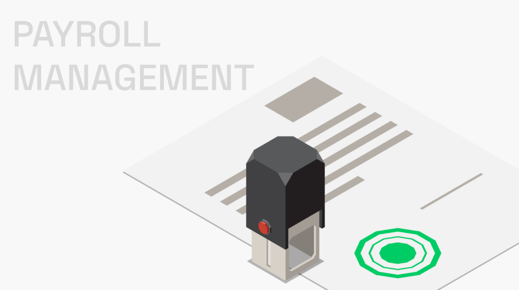
By using geofencing tech, you can automate clock-ins and clock-outs for your drivers and staff based on their location. This can help:
- Make sure everyone gets paid accurately without the hassle of manual entries.
- Cut down on buddy punching and time fraud, keeping your payroll legit.
- Save time for managers by reducing the paperwork involved in tracking hours.
Example: Delivery driver rolls up to the warehouse, and as soon as they step on-site, the system automatically clocks them in. No more forgetting to punch in or out – everyone’s hours are tracked seamlessly, making payday a breeze.
10. Improve reporting

By creating virtual boundaries around key locations, you can automatically track and record data on asset movements and driver activities. This can help:
- Generate accurate reports without manual data entry, saving time and effort.
- Provide detailed insights into route efficiency and operational performance.
- Spot trends and issues quickly with real-time data collection and analysis.
Example: Imagine you’ve set up geofences around delivery zones and warehouses. As vehicles move in and out, the system automatically logs their activity and generates reports, giving you clear insights into how routes and operations are running. No more digging through spreadsheets – everything you need is right at your fingertips.
10 time-tested steps to implement geofencing in logistics operations
Getting geofencing rolling in logistics is all about a solid plan to make it work right.
Step 1: Define your objectives

First things first, figure out what you want to achieve. Are you looking to save time at customer spots, keep unauthorized drivers in check, or just make your communication game stronger?
Nail down your goals like:
- tracking vehicle locations,
- optimizing routes,
- boosting security,
- setting up auto-updates for deliveries.
Think about where geofencing can really make a difference, like at warehouses, distribution hubs, or high-security zones. With clear targets, you can prioritize features and measure success.
Step 2: Choose a geofencing platform

Select a geofencing-enabled fleet management system or logistics software. Make sure it vibes with your current setups, like GPS and telematics, so you ain’t starting from scratch.
Verify that it provides real-time visibility and reporting features. Look for platforms with good user support and scalability options.
You want something that’s gonna keep everything synced and running smoothly. Check reviews, ask around – don’t settle for the first option that pops up. A solid platform is the backbone of your geofencing game. Look for features that cater specifically to logistics needs.
Step 3: Set up geofences

Use your chosen platform to draw virtual boundaries (geofences) around key locations. This can be done using coordinates or by marking areas on a digital map.
Geofences can be circular or polygonal, depending on the shape of the area you want to monitor. Make sure the boundaries are tight, so you’re not missing anything. It’s all about keeping an eye on where your assets are at all times.
Keep it simple and straightforward, so everyone knows where the zones are.
Step 4: Integrate with the fleet management system

Now it’s time to plug your geofencing system into your fleet management software. This step is crucial for real-time tracking of vehicles zipping in and out of your geofenced areas.
Make sure you’re capturing all vehicle data you need – location, speed, driver behavior, and how long they hang around.
A solid integration will make your life way easier and your operations smoother. Plus, it’s gonna keep everyone in the loop about what’s happening on the road.
Step 5: Set notifications and alerts
Configure automated notifications and alerts. These could be for when vehicles enter or exit specific geofenced areas.
Think about unusual behavior too – like trucks overstaying their welcome or entering no-go zones.
Alerts can be sent via email, SMS, or in-app notifications to relevant personnel. It’s all about keeping communication flowing without drowning them in info.
Step 6: Implement geofencing rules

This is where you lay down the law. Define some solid rules for your geofences based on your logistics operations. For example:
- Notify warehouse staff when a truck is 15 minutes away.
- Restrict access to certain areas or times for vehicles.
- Automate documentation or invoicing upon arrival or departure from geofenced areas.
Clear rules make sure everyone’s on the same page and keep things running like a well-oiled machine.
Step 7: Test and optimize

Before you go all out, run a pilot test with a handful of vehicles and geofenced spots. This is your chance to see if everything’s clicking together.
Keep an eye on how well the system tracks data and sends out alerts. Fine-tune the size and shape of your geofences to make sure they fit just right.
Testing gives you the lowdown on what works and what doesn’t. Gather feedback from your team to see what’s jiving and what’s not. A solid test run will set you up for success down the line.
Step 8: Monitor and analyze data
Now that your system is live, it’s all about the data game.
Use the system to collect data on vehicle activity, route efficiency, idle time, and any breaches of geofenced areas. Look for patterns and anomalies—maybe some routes consistently take longer than expected, or certain vehicles are spending too much time in non-designated areas.
This analysis will give you insight into potential bottlenecks or inefficiencies in your logistics process.
Step 9: Scale implementation
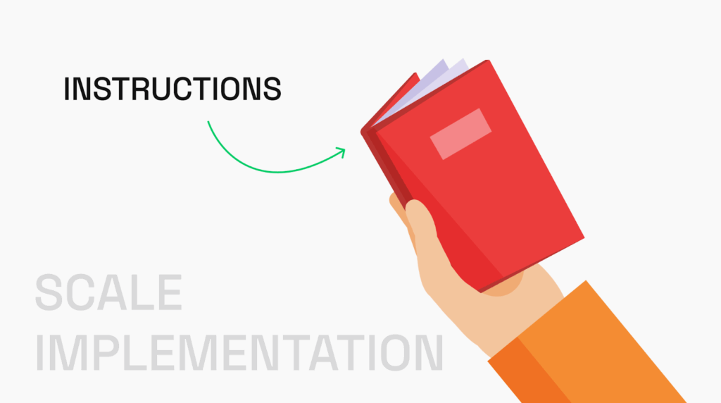
Once the pilot phase is successful, roll out geofencing across the entire fleet. Ensure all drivers and relevant staff are trained on the system. Providing comprehensive training sessions and easy-to-follow resources will help everyone get on board and make the most of the new system.
As your operations grow or evolve, you may need to tweak your geofences accordingly, maybe by adding new delivery routes or adjusting existing ones. This could involve reshaping the boundaries, adding new geofences for new locations, or even setting new alerts based on changing operational needs.
Step 10: Ensure compliance and security

Different regions have varying laws about data privacy and tracking, so make sure your geofencing solution aligns with those regulations. For example, in the EU, the General Data Protection Regulation (GDPR) sets strict rules about data collection and consent.
Next, let’s talk about security. With all that sensitive data floating around, you need to lock it down. Start by implementing strong authentication measures – think multi-factor authentication for access to your geofencing system. Additionally, encrypt data both in transit and at rest. Regularly update your software and systems to patch any vulnerabilities that hackers might exploit. It’s also wise to conduct regular security audits to identify potential weaknesses in your setup.
An example of integrating geofencing in a custom app we built for our client

Volpis is a software development company that specializes in developing custom apps for businesses. We have recently implemented geofencing for RoadHunter, a navigation system made for truck drivers.
With geofencing, the app sends alerts to drivers when they approach important locations, like construction zones and low bridges, or areas affected by severe weather conditions, helping them navigate smoothly. We invite you to download the app from the Apple Store and explore its features.
Our team, consisting of over 40 in-house experts, brings extensive experience and creativity to each project. If you’re planning to implement geofencing for your business and considering all the pros and cons, we’re always here to assist.
How Volpis can help you deploy geofencing and bring your logistics app idea to life
Regularly ranked among the Top Custom Software Development Companies on Clutch, Volpis has been leveraging the power of technology to assist logistics business owners in reaching unparalleled milestones. Our commitment to excellence is reflected in the glowing reviews from our customers, who consistently praise our dedication to delivering exceptional results.

Read more reviews from our valuable customers here
We invite you to explore our portfolio for a detailed look at the innovative software systems we have developed for our clients. Our team understands the nuances of the logistics industry and is committed to providing solutions that are tailored to your unique goals.
We’d love to answer any questions you may have. You can reach out to us via info@volpis.com with any questions or to explore how we can be part of your journey.
Questions & Answers
FAQ
What is geofencing in logistics?
Geofencing in logistics involves using virtual boundaries to manage operations effectively. Logistics companies set up these defined areas around specific locations, allowing for precise tracking of vehicles and assets. By leveraging location data, they can monitor movements in real-time. This technology enhances logistics management by automating notifications when assets enter or leave a geofenced location. It also improves operational control, reducing human error in tracking deliveries. With historical data, companies can analyze trends and optimize routes. Ultimately, geofencing gives logistics companies a competitive edge in the market. It transforms how they handle asset tracking and ensures a smoother supply chain process.
Is geofencing suitable for all logistics companies?
Yes, geofencing can be adapted to suit logistics companies of all sizes. Whether managing a small fleet or operating a large logistics network, geofencing can be customized to meet specific needs, from enhancing delivery operations to improving security and compliance in both local and global supply chains.
Can I develop my own geofencing system for logistics?
Yes, you can develop a custom geofencing system tailored to your specific logistics needs. Many companies opt for custom-built geofencing systems to ensure the technology integrates seamlessly with their existing operations, fleet management, and CRM systems. Working with a development partner, like us, ensures that the system is designed to meet your unique requirements.
What is a geofence in delivery?
A geofence in delivery is a virtual boundary set around a specific area where deliveries occur. This boundary allows logistics companies to track when a vehicle enters or exits a geofenced location. By utilizing geofencing software, companies can send alerts to drivers and customers, enhancing the delivery experience. It ensures timely updates, which contributes to higher customer satisfaction. With precise location data, delivery operations become more efficient, reducing delays and errors. Supply chain managers can use this technology to optimize routes and improve delivery times. The right geofencing solution can significantly impact a company’s operational control. It helps them stay ahead in a competitive market.
What is the purpose of geofencing?
The purpose of geofencing is to create virtual boundaries for better management of logistics operations. It allows logistics companies to monitor their assets and vehicles in real time, enhancing operational efficiency. By using geofencing, businesses can reduce human error and streamline processes. This technology enables informed decisions based on accurate location data. Geofencing also aids in improving customer experience by providing timely updates about deliveries. For supply chain managers, it offers a way to optimize routes and resources effectively. The ultimate goal is to boost customer satisfaction and gain a competitive advantage in the industry. It’s a powerful tool for modern logistics management.
What is geofencing in trucking?
Geofencing in trucking refers to the use of virtual boundaries to enhance route management and safety. By integrating geofencing technology, trucking companies can track their vehicles as they cross predefined areas. This is particularly useful for monitoring compliance with regulations, like avoiding low bridges or construction zones. With asset tracking capabilities, companies can respond quickly to any deviations from planned routes. Geofencing also allows for better management of driver performance, ensuring they adhere to safe driving practices. By utilizing historical data, logistics companies can analyze trends and improve their strategies. The right geofencing solution helps trucking firms maintain operational control while reducing costs. Ultimately, it enhances the overall efficiency of trucking operations.