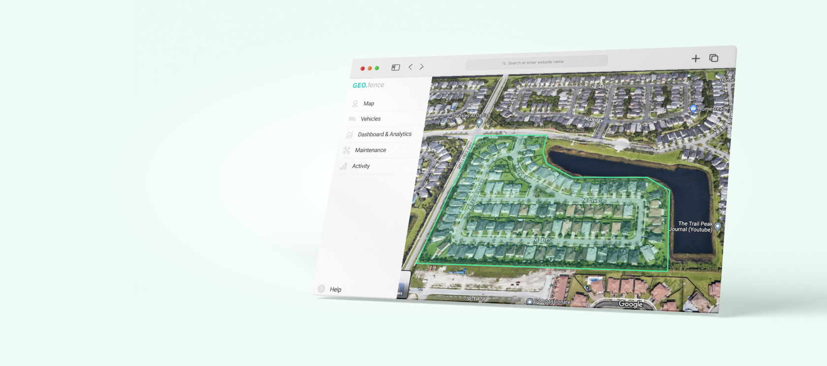

- The global geofencing market is expected to grow from $7.031 billion in 2025 to $18.01 billion by 2035.
39% of supply chain leaders report growing operational costs, which makes them seek ways to optimize fleet operations through technologies like geofencing. - The key benefits that geofencing can deliver to fleet businesses include simplified payroll management, improved driver safety, protected fleet assets, compliance support, and improved reporting accuracy.
- Alert fatigue from too many geofences is the most common reason many geofencing implementations fail to deliver value.
- AI in driver management can cut distracted driving by 20%, hard braking by 9%, and speeding by 27%, and such models can be effectively paired with geofencing and telematics systems to deliver even more value.
GPS fleet tracking gives fleet operators a certain level of control: they can see where every vehicle is. The problem is that this approach is merely reactive. Operators see dots on the map and start acting only when something goes wrong. In conditions when 39% of supply chain leaders report growing operational costs, according to McKinsey’s report on supply chain risks, such limitations in fleet oversight often become too expensive to ignore.
Geofencing brings the change. It turns your map into a rule-based system that fires an alert the moment a vehicle crosses a line you’ve drawn. Whether it involves entering a restricted zone, deviating from the assigned route, or unauthorized vehicle use, your operators remain in control.
In this guide, I’ll draw on 10+ years of experience building fleet management software to explain how geofencing works, where it delivers the most value, and how to avoid turning it into a flood of alerts that nobody pays attention to. This article focuses specifically on the use of this technology in fleet management. For insights on the use of geofencing in logistics operations, check out my recent article.
What is geofencing in fleet management?
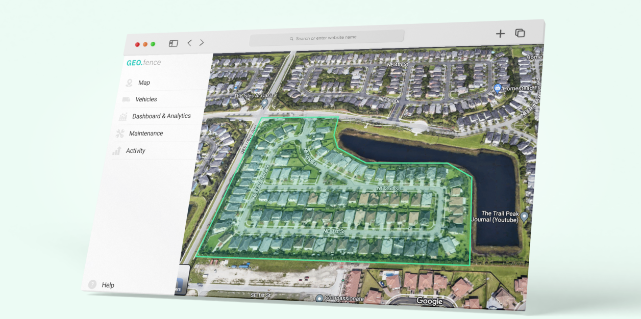
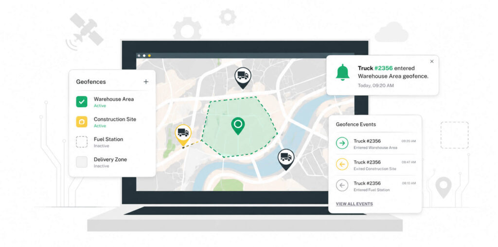
Geofencing is a live tracking approach that relies on geofences – virtual boundaries on a digital map around a real-world place. These geofences can be either circular (defined by a center point and a radius), polygon (using custom shape drawn on the map), or corridor (relying on a band created around a defined route).
When a GPS-equipped vehicle crosses such a boundary, the system registers an event. It records entry, exit, or time spent inside the geofenced zone. That event can trigger an alert delivered to the right person automatically. It’s the basic building block behind fleet management systems that go beyond simple real-time vehicle tracking.
Geofencing technology becomes more accessible and is no longer reserved for large enterprises. Fleet telematics hardware has dropped in cost, GPS coverage is near-universal, and cloud-based fleet platforms can process thousands of geofence events per day at negligible compute cost.
How does fleet geofencing work?
Fleet management geofencing typically relies on GPS as the primary geographical positioning system for outdoor tracking. There are several variations of such systems used in indoor geofencing, such as BLE beacons, Wi-Fi positioning, RFID, and UWB. You can find a more detailed overview and comparison of these in my article on geofencing use cases.
At the core of geofence-enabled vehicle location tracking is the trigger logic. The system polls vehicle position at regular intervals, compares each position fix against every active geofence polygon, and evaluates whether a state change has occurred. Entry or exit fires a trigger that routes to a webhook, push notification, dispatcher alert, or an automatic log entry.

For a deeper look at the hardware layer that makes this work, see my guide to IoT sensors in fleet systems.
5 ways geofencing improves fleet operations
Vehicle geofencing takes over many of the routine checks fleet managers would otherwise have to track themselves. Below are five common operational problems it helps solve, along with examples from real-world fleet deployments.
1. Simplified payroll management
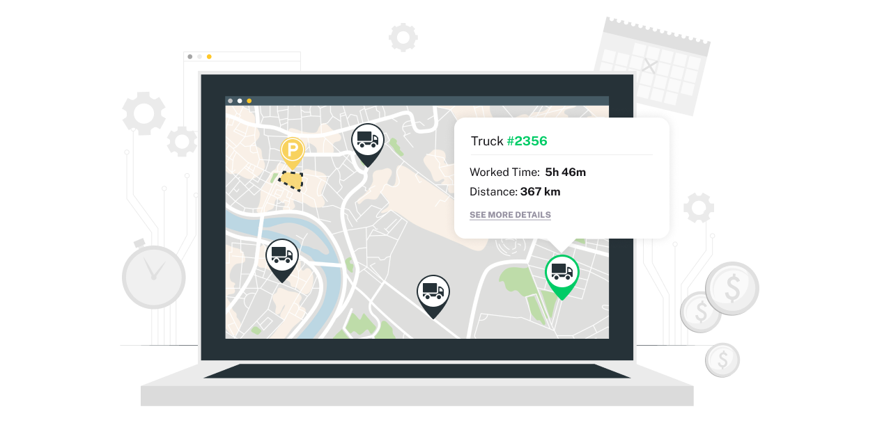
Geofence entry and exit timestamps replace manual timesheets entirely. When a driver enters a job site, the system logs a clock-in. When they leave, it logs a clock-out. The time data comes from the vehicle’s positioning system, not from a person’s recollection of when they arrived.
This matters because timesheet disputes often cause payroll friction in field service and construction fleets. Drivers and managers disagree on arrival times, break durations, and site departures. Geofence-based logging removes the ambiguity.
When our team delivered the FleetSu fleet management platform, its geofence-based time logging cut the customer’s time sheet disputes to zero within the first few months.
2. Improved driving safety
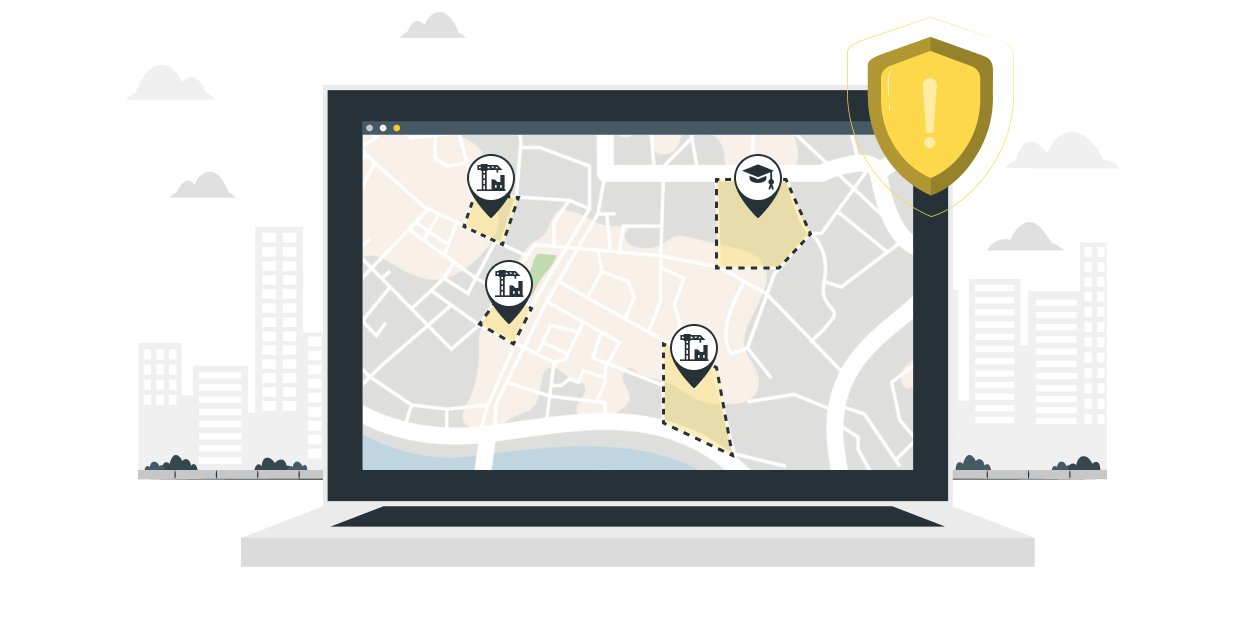
Geofencing improves driving safety by alerting dispatchers and drivers when a vehicle enters a prohibited zone. For example, set a GPS geofence around a school zone, a low-clearance bridge, or a hazardous material restricted area. The moment a vehicle crosses the boundary, the right person gets notified in real time.
Curfew alerts work the same way, but are time-bound. A vehicle that enters an unauthorized zone outside normal operating hours triggers an immediate alert. You don’t need to review 12 hours of GPS replay to spot the deviation – the system flags it when it happens. Also, by continuously tracking location and temperature in real time and triggering alerts when conditions deviate from safe thresholds or routes, geofencing and GPS tracking help you guarantee the integrity of temperature-sensitive freight during transportation.
The more powerful safety application is combining geofence zone data with speed data. If you know a vehicle is inside a school zone, and its speed exceeds 20 mph, you have a specific, actionable alert – not just “this driver drives fast.” In fact, better control over aggressive driver habits can help you improve fuel economy by 10-40% in stop-and-go traffic, according to the U.S. Department of Energy. For more insights on using data in driver behavior monitoring, see my post on how to improve driver behavior with fleet software.
3. Protected fleet assets
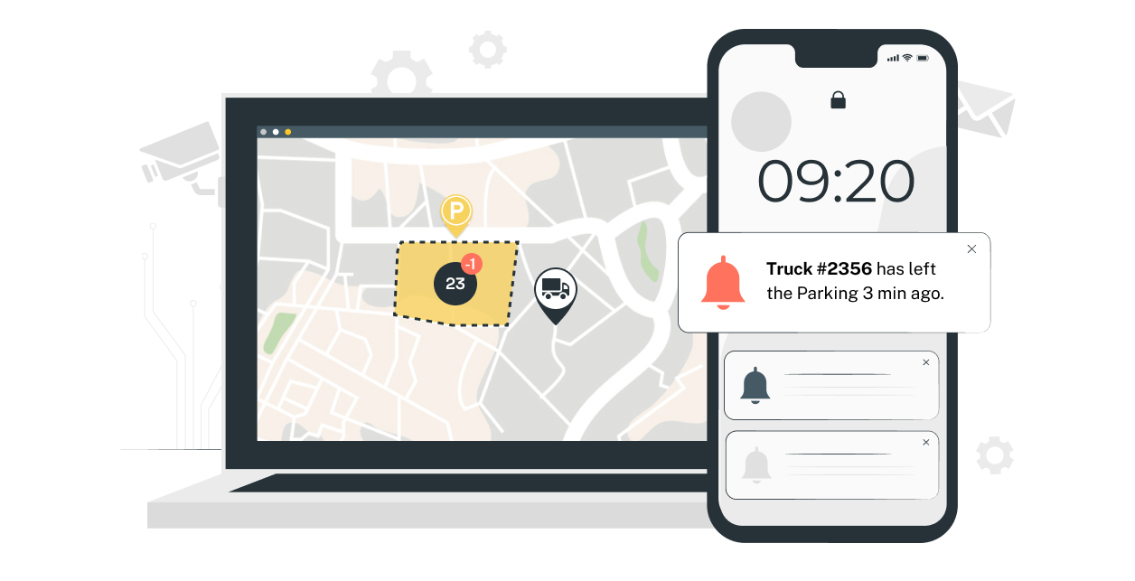
An after-hours boundary breach on a depot or job site is your earliest warning sign of vehicle theft. According to the Trans.Info report, there were over 30,500 cargo crime incidents, with documented losses of €860.5m in Europe in 2024-2025. That number reflects organized cargo theft, but opportunistic vehicle theft follows similar patterns: vehicles move at night, fast, and in directions that make no operational sense.
Vehicle geofencing gives you the detection layer. For example, when a vehicle exits a depot geofence during the scheduled downtime, it will take a system a few seconds to notify the dispatchers. They can contact the on-call manager immediately and check whether a driver authorized the movement. If there is no such authorization, the dispatchers contact the police and provide them with real-time GPS coordinates.
In FleetSu, the most requested geofence trigger was after-hours vehicle movement. We set up automatic alerts to the dispatcher and vehicle owner within 30 seconds of a boundary breach. The client had previously only discovered unauthorized vehicle use when reviewing fuel receipts three days later.
4. Compliance support
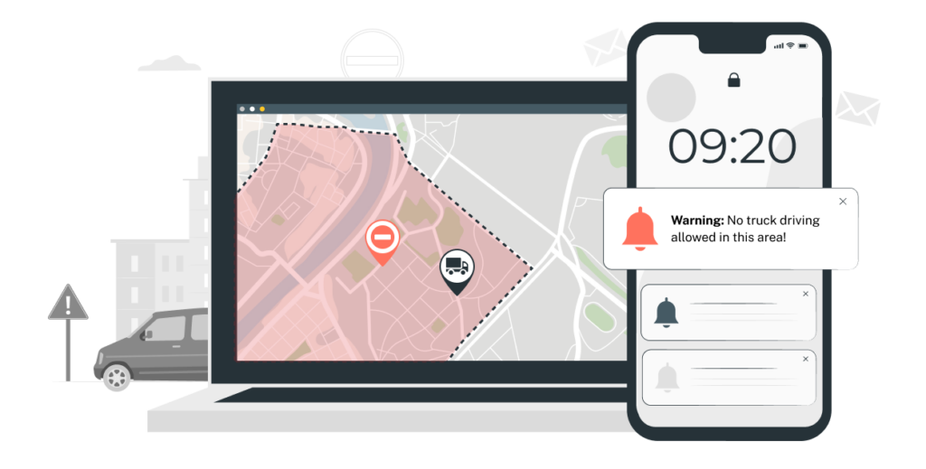
Fleet geofencing creates an automatic, timestamped record of where every vehicle was and when. For fleets operating under Hours of Service compliance rules, geofences at approved rest stops, and depots confirm that mandatory breaks were taken at authorized locations – not just that the driver pressed a button on an electronic logging device (ELD). For fleet compliance requirements involving restricted zone access, the geofence log is the audit trail.
Another use case is permit compliance. Oversized vehicles operating under a specific route permit need to stay on that route. A corridor geofence that matches the permitted path generates an automatic violation record the moment the vehicle deviates. This notification is useful for both self-auditing and regulatory reporting.
The value isn’t just in catching violations. It’s recording necessary data in fleet compliance software. When an auditor asks for proof that a vehicle stayed within a permitted zone on a specific date, the geofence event log is a timestamped, typically GPS-sourced, record. It’s more defensible than driver logs and more complete than paper documentation.
5. Improved reporting accuracy
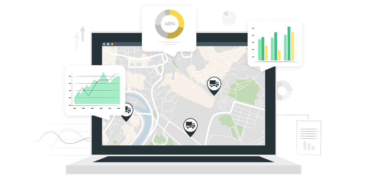
Raw data provided by fleet geofencing tools, such as arrival and departure logs, automatically feeds directly into billing, SLA verification, client visit proof, and driver performance reports.
For service fleets that bill by job site visits, geofence data serves as the source of truth. Clients can’t dispute an arrival time that’s recorded by satellite. For driver performance, geofence dwell-time data shows which drivers spend an appropriate time on site and which ones are cutting visits short. To connect reporting accuracy to cost outcomes, see my analysis of how to reduce fleet operating costs.
You can use such automatically generated reports to find problems in transportation workflows and identify areas for improvement. Insights from geofencing fleet tracking can give a solid basis for optimizing your fleet management operations.
The reporting benefit compounds over time. After 90 days of geofence data, you have a baseline for normal site visit durations. From my industry knowledge, any visit that’s 40% shorter than baseline is worth reviewing – not as a disciplinary trigger, but as a signal that something on that route changed.
How to implement fleet management geofencing: 4 steps
Most geofencing rollouts fail not because of technical problems, but because teams deploy too many zones too fast and drown in alerts nobody acts on. These four steps prevent that.
Step 1: Define your zones
Start with the three to five locations that matter most – your home depot, your two or three highest-priority client sites, and any restricted zones relevant to your permits or safety policy. Keep the number of zones low and do not try to cover too much from the start. You can always add more zones once everything starts working and bringing measurable results.
Step 2: Set trigger rules
Define what each geofence should trigger: entry alert, exit alert, after-hours monitoring, or dwell-time thresholds. A system with one trigger per zone is typically easier to manage. For example, a depot geofence may only trigger on after-hours exits. A client site geofence might simply log entries and exits for billing, without real-time alerts.
Step 3: Configure alerts
Route each alert to the right person. Dispatchers should be notified about route deviations, fleet managers should get alerts about after-hours breaches, and drivers should receive curfew warnings. If every alert goes to everyone, no one treats any of them as urgent. Alert routing is as important as zone definition.
Step 4: Monitor and refine
Review geofence event data weekly for the first month. Look for false positives – vehicles triggering exit events because they parked near the boundary edge, or GPS drift nudging a position fix across the line. Adjust radii and hold-off timers based on what you see. A well-calibrated vehicle geofencing setup takes two to three iterations.
Fleet geofencing best practices
Fleet management geofencing works well when implemented in a smart way: with focus on operational reality and real technology expertise. Here’s what separates setups that stick from setups that get disabled after two weeks.
- Communicate with drivers before go-live. When drivers understand why geofences exist – payroll accuracy, safety, vehicle theft prevention – false-positive complaints drop. When they find out about it after the fact, they assume surveillance and push back hard. Run a five-minute briefing before launch.
- Set buffer zones. A 50-meter buffer around a boundary edge prevents false exits from GPS drift. If your depot boundary is tight against the road, vehicles parked near the exit will drift in and out of the zone with every GPS update cycle. Expand the boundary or add a buffer radius.
- Review alerts weekly, not daily. Daily review creates noise and alarm fatigue for the manager doing the review. Weekly patterns reveal real problems, such as a vehicle that left the service area three times this week or a driver whose site dwell time dropped 50% over the past month.
GPS signal loss is a common problem in fleet management that requires a technical solution rather than operational-level changes. While working on the RoadHunter trucking app, we faced a problem with GPS signal dropout in mountainous regions. Trucks passing through areas with poor satellite visibility were generating position gaps that, when the GPS reconnected, looked like sudden jumps outside the corridor. We solved this by applying a Kalman filter to smooth the GPS fleet tracking before evaluation, combined with a 90-second confirmation window before firing a deviation alert.
How AI is changing fleet geofencing
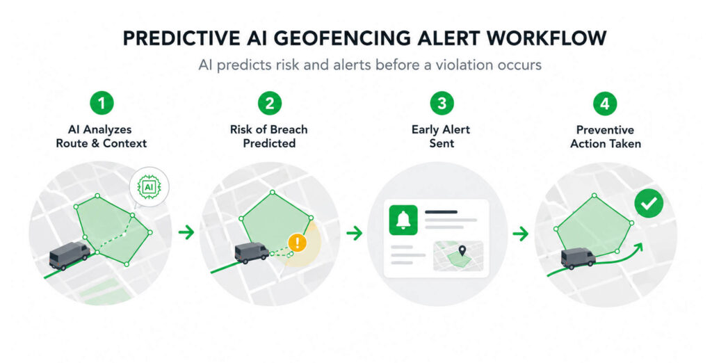
According to the Market Research Future report, the active geofencing market is projected to grow from $7.031 billion in 2025 to $18.01 billion by 2035. As the market evolves, so do technologies used in combination with geofencing. In particular, the growing adoption of AI makes geofencing predictive rather than just reactive.
For example, the Cambridge Mobile Telematics study reveals that the use of AI in driver management can cut distracted driving by 20%, hard braking by 9%, and speeding by 27%. A well-thought-out combination of AI models, fleet telematics, and geofencing can bring massive savings in both cost and reputation.
- Auto-zone suggestion is the most immediately practical AI feature. Machine learning analyzes 90 days of historical GPS stop data and recommends new geofence zones based on where vehicles actually stop regularly – not where a manager assumed they stop. With such capabilities, you stop guessing which locations need geofences and let the vehicle data tell you.
- Predictive boundary alerts go further. Instead of alerting after a vehicle crosses a boundary, AI models vehicle heading, speed, and historical deviation probability to predict a breach before it happens. Dispatch gets a warning while the vehicle is still 200 meters from the boundary – enough time to contact the driver and offer logistics route optimization suggestions before the deviation makes an impact.
- Behavioral baselining eliminates false positives at scale. Instead of firing an alert every time a vehicle takes a route that differs from the direct path, AI learns each driver’s normal patterns. If a driver takes the same shortcut every Tuesday, the system stops flagging it. Alerts only fire on genuine deviations – an unusual stop, a route that goes nowhere near any known destination.
- Maintenance automation on geofence entry connects the location layer to the operational layer. When a vehicle enters the depot geofence, the system automatically surfaces overdue inspections in the maintenance queue. No dispatcher has to remember to check. The geofence event triggers the workflow.
For a broader look at how AI is reshaping fleet operations beyond geofencing, see my guide to AI and machine learning in fleet management.
Conclusions
Geofencing isn’t complicated – it’s just rules attached to places. What matters is implementation discipline: start small, route alerts to the right people, and refine based on real data. From my experience, a common mistake is treating it as a surveillance tool while, in reality, it is a multi-functional operational system.
The fitting approach shows up in payroll accuracy, safety outcomes, and how drivers respond. As AI adoption grows, the advantage shifts from knowing where vehicles are to predicting where they’re going. The shift is evident – reactive systems transition toward a proactive approach.
Whether you need to add geofencing to an existing platform or at the system level as part of a full fleet platform build, we are ready to help. We’ve solved the hard problems: GPS fleet tracking drift, corridor evaluation, alert routing, PostGIS integration, and false-positive mitigation.
Schedule a free consultation to see how our fleet management software service specialists can help you benefit from geofencing.
Questions & Answers
FAQ
How accurate is geofencing technology in fleet management?
Modern positioning systems can typically determine a vehicle’s location within a few meters in open areas, but accuracy decreases in environments such as tunnels, underground parking facilities, and dense urban streets where satellite signals are obstructed. When satellite-based positioning is not available, cellular network positioning can provide continued coverage. Still, it offers a much lower accuracy, often ranging from tens to several hundred meters, depending on network conditions and infrastructure.
Are there privacy concerns with geofencing in fleet management?
Fleet management geofencing tracks vehicle location, not personal movement – but the line blurs when drivers use company vehicles for personal trips. Most fleet geofencing systems limit tracking to working hours only. Policies should be documented, communicated to drivers upfront, and compliant with local data protection laws, including GDPR in Europe. Driver consent and transparency matter both legally and operationally.
How does geofencing integrate with existing fleet management software?
Geofencing is usually set up through APIs or webhooks. Vehicle location data is sent to a geofencing service, which checks whether a vehicle has entered, left, or stayed within a defined area and then generates the relevant event. Most fleet telematics platforms already include geofencing features and provide APIs for integrating them with other systems. If you’re building a custom fleet management platform, geofence checks can also be handled directly using spatial databases or mapping libraries.
What types of alerts does fleet geofencing trigger?
The most common alerts include geofence entry, geofence exit, after-hours boundary breach, dwell-time threshold (vehicle stopped inside a zone longer than expected), and corridor deviation (vehicle departed from an approved route). These alerts are then delivered to corresponding specialists, depending on your configurations and workflows.
Which industries benefit most from fleet geofencing?
Trucking and long-haul logistics use corridor geofencing to verify approved routes for high-value loads. Construction fleet management systems use site perimeter geofences to log equipment arrival and departure for payroll and billing. Oil and gas fleets use restricted zone alerts for safety compliance. Car rental companies use after-hours breach alerts for vehicle theft prevention. Each use case maps to a specific geofence type and trigger rule.